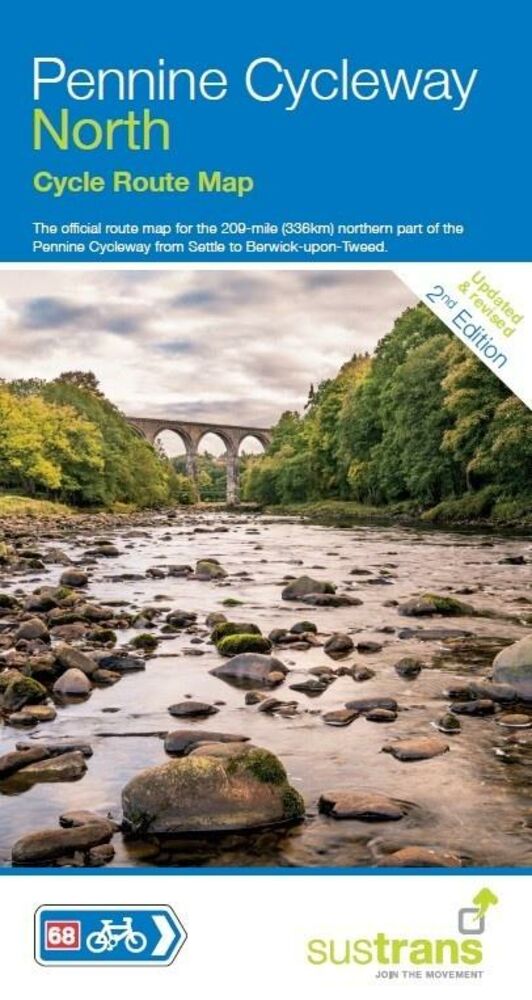
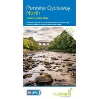
SUSTRANS MAPS FIETSKAART PENNINE CYCLEWAY NORTH (9781910845356) ROUTE 68 SETTLE TO BERWICK-UPON-TWEED IS NIET LEVERBAAR
Dit artikel is niet leverbaar. Het wordt niet meer gemaakt, zit niet meer in ons assortiment, of kunnen wij er simpelweg (nu) niet aan komen.
Artikelen die wij wel op voorraad hebben in deze groep (Noord-Engeland):


OMSCHRIJVING
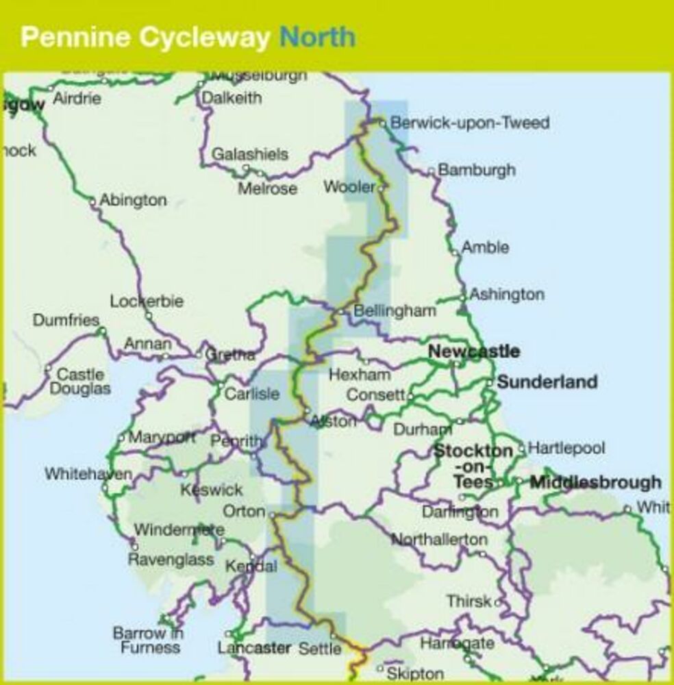
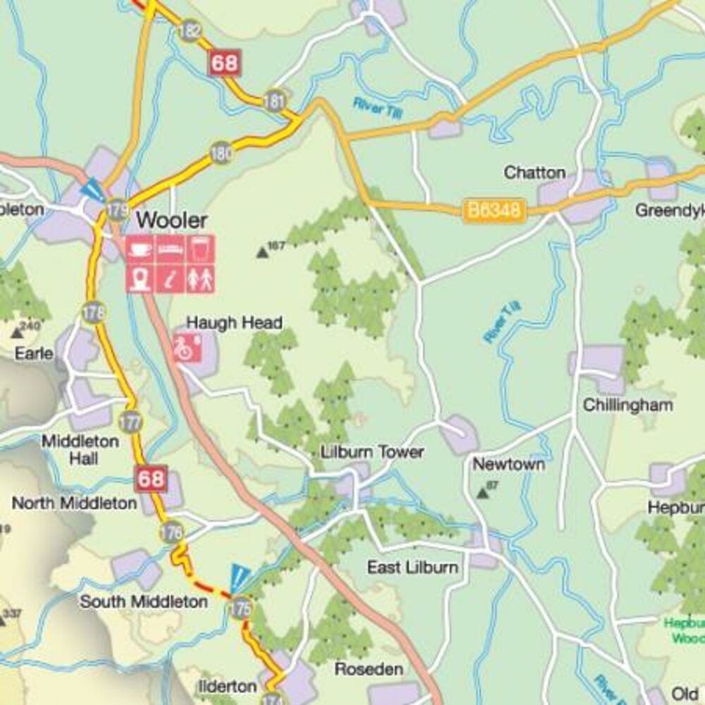
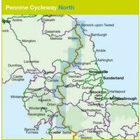
Fietskaart van het noordelijk deel van de Pennine Cycleway: 336 kilometer tussen Berwick-upon-Tweed en Settle. National Cycle ROute 68.
Deze fietskaart is vooral geschikt als je deze route wilt fietsen. Als fietskaart voor de omgeving buiten de route is deze niet zo overzichtelijk:
- Schaal 1:110.000 (1 cm = 1,1 km)
- Gedetailleerde centrumkaarten
- Bezienswwaardigheden, fietszaken, eten en drinken onderweg
- Hoogteprofielen
This linear map shows the route and immediate surrounding area over a series of separate map panels. The full colour map based on Ordnance Survey data shows clearly mapped cycle routes on traffic-free paths, quiet lanes and roads, with easy to read contours, route profiles and mile markers. Also features detailed inset maps for the major towns and cities, tourist info and cycle shop and hire information, and other local routes.
The southern half of the Pennine Cycleway is a beautiful, yet challenging ride which takes you through the dramatic scenery of the Peak District and the South Pennines. The route takes you from the bustling railway city of Derby to the historic town of Settle, taking in the famous spa town of Buxton and the lovely Yorkshire town of Holmfirth, renowned location of the TV classic “Last of the Summer Wine”.
This section includes the popular traffic-free Tissington and Longdendale Trails and includes part of the renowned High Peak Trail. The ride takes you through a wide variety of landscapes, including a huge canal embankment, splendid examples of textile mills, delightful market towns, pastoral farmland and high open moorland. Traffic-free sections include the green corridor of the Leeds and Liverpool Canal towpath, bridle tracks near Clapham, the path alongside Torside and Woodhead reservoirs and the glorious Tissington Trail which follows the line of former London and North Western railway line through the Peak District.
You’ll find plenty to see and do along the route in places such as Ashbourne, Whaley Bridge and Hebden Bridge. If you want some bright lights there’s a route option which takes you to Burnley, or you take the picturesque way and ride to Colne as you wend your way towards Widdop Reservoir and out over Widdop Moor before you reach Settle, adjacent to the beautiful Forest of Bowland Area of Outstanding Natural Beauty.
Bekijk alle Europa
OMSCHRIJVING
Deze fietskaart is vooral geschikt als je deze route wilt fietsen. Als fietskaart voor de omgeving buiten de route is deze niet zo overzichtelijk:
- Schaal 1:110.000 (1 cm = 1,1 km)
- Gedetailleerde centrumkaarten
- Bezienswwaardigheden, fietszaken, eten en drinken onderweg
- Hoogteprofielen
This linear map shows the route and immediate surrounding area over a series of separate map panels. The full colour map based on Ordnance Survey data shows clearly mapped cycle routes on traffic-free paths, quiet lanes and roads, with easy to read contours, route profiles and mile markers. Also features detailed inset maps for the major towns and cities, tourist info and cycle shop and hire information, and other local routes.
The southern half of the Pennine Cycleway is a beautiful, yet challenging ride which takes you through the dramatic scenery of the Peak District and the South Pennines. The route takes you from the bustling railway city of Derby to the historic town of Settle, taking in the famous spa town of Buxton and the lovely Yorkshire town of Holmfirth, renowned location of the TV classic “Last of the Summer Wine”.
This section includes the popular traffic-free Tissington and Longdendale Trails and includes part of the renowned High Peak Trail. The ride takes you through a wide variety of landscapes, including a huge canal embankment, splendid examples of textile mills, delightful market towns, pastoral farmland and high open moorland. Traffic-free sections include the green corridor of the Leeds and Liverpool Canal towpath, bridle tracks near Clapham, the path alongside Torside and Woodhead reservoirs and the glorious Tissington Trail which follows the line of former London and North Western railway line through the Peak District.
You’ll find plenty to see and do along the route in places such as Ashbourne, Whaley Bridge and Hebden Bridge. If you want some bright lights there’s a route option which takes you to Burnley, or you take the picturesque way and ride to Colne as you wend your way towards Widdop Reservoir and out over Widdop Moor before you reach Settle, adjacent to the beautiful Forest of Bowland Area of Outstanding Natural Beauty.
Bekijk alle Europa
PRODUCTINFORMATIE SUSTRANS MAPS FIETSKAART PENNINE CYCLEWAY NORTH
PRODUCTINFORMATIE SUSTRANS MAPS FIETSKAART PENNINE CYCLEWAY NORTH
HET MERK SUSTRANS MAPS

De fietskaarten van Sustrans Maps dekken nagenoeg het gehele Britse National Cyce Network.
HET MERK SUSTRANS MAPS
De fietskaarten van Sustrans Maps dekken nagenoeg het gehele Britse National Cyce Network.
GARANTIE
Of u het product online via de webshop of in onze fysieke winkel gekocht heeft, de garantie is voor Zwerfkei hetzelfde. De garantietermijn kan per product en merk verschillen, van één jaar tot de volledige levensduur van het product. Garantie geldt in principe op alle materiaal- en/of fabricagefouten, en niet op defecten als gevolg van slijtage of verkeerd gebruik. In het geval van garantie wordt het defecte product vervangen, vergoed of hersteld door de fabrikant/importeur of door een professionele en gespecialiseerde reparateur.
Zwerfkei verzorgt de begeleiding en de afhandeling van garantiegevallen voor u. Wij bieden het product na beoordeling ter reparatie aan bij de fabrikant/importeur of één van hun professionele servicediensten. Wij onderhouden goede contacten met onze servicediensten en samen zorgen wij ervoor dat elk defect zo snel mogelijk opgelost wordt.
SUSTRANS MAPS FIETSKAART PENNINE CYCLEWAY NORTH KOPEN?
KEUZEHULP
OPENINGSTIJDEN
| Ma | gesloten |
| Di | 09:00 - 18:00 uur |
| Wo | 09:00 - 18:00 uur |
| Do | 09:00 - 18:00 uur |
| Vr | 09:00 - 21:00 uur |
| Za | 09:00 - 17:00 uur |
| Zo | gesloten |
Volgende week:
| Ma | 13:00 - 18:00 uur |
| Di | 09:00 - 18:00 uur |
| Wo | 09:00 - 18:00 uur |
| Do | 09:00 - 18:00 uur |
| Vr | 09:00 - 21:00 uur |
| Za | 09:00 - 17:00 uur |
| Zo | gesloten |
3446 CR Woerden
0348-421648
ANDERE KLANTEN KOCHTEN OOK