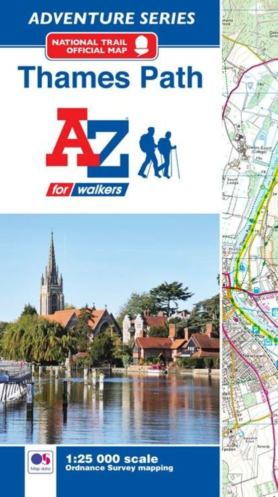
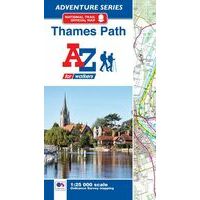
AZ MAPS THAMES PATH ADVENTURE ATLAS (9781782571605) WANDELATLAS IS NIET LEVERBAAR
Dit artikel is niet leverbaar. Het wordt niet meer gemaakt, zit niet meer in ons assortiment, of kunnen wij er simpelweg (nu) niet aan komen.
Artikelen die wij wel op voorraad hebben in deze groep (Londen):


KEUZEHULP
OMSCHRIJVING
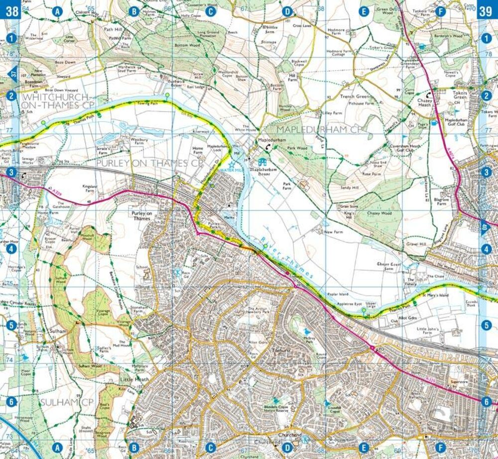
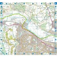
Zeer gedetailleerde gevouwen wandelatlas van het volledige traject van de Thames Path: 184 miles van de bron tot de Thames Barrier.
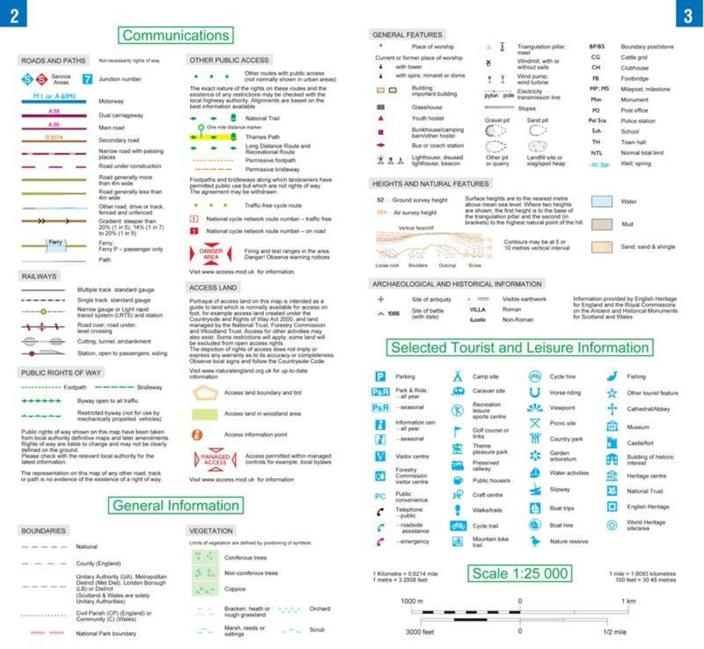
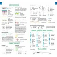
-kaartmateriaal 1:25.000 ( Ordnance Survey)
The A-Z Adventure series features the accuracy and quality of Ordnance Survey's 1:25000 mapping in a convenient book, therefore eliminating the need to fold and re-fold a large sheet map to the desired area. OS 1:25000 is Ordnance Survey's most detailed mapping, showing public rights of way, open access land, national parks, tourist information, car parks, public houses and camping and caravan sites.
The Thames Path is a National Trail which covers 296km (184 miles) and follows the length of Englands longest river, the Thames, from its source in the Cotswolds to the Thames Barrier in Greenwich, London.
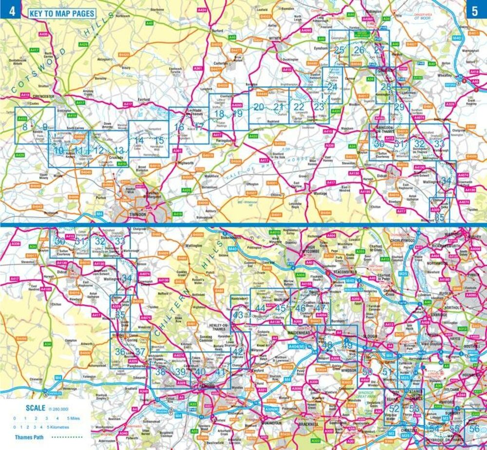
This A-Z Adventure Atlas of the Thames Path features 60 pages of continuous Ordnance Survey mapping providing complete coverage of the Thames Path. Clearly highlighted in yellow, the route is easy to identify and shows both north and south bank alternatives. In addition mileage markers have been introduced to the map making it easy to gauge distances when planning your own sections of the walk to enjoy.
Bekijk alle Europa
OMSCHRIJVING
-kaartmateriaal 1:25.000 ( Ordnance Survey)
The A-Z Adventure series features the accuracy and quality of Ordnance Survey's 1:25000 mapping in a convenient book, therefore eliminating the need to fold and re-fold a large sheet map to the desired area. OS 1:25000 is Ordnance Survey's most detailed mapping, showing public rights of way, open access land, national parks, tourist information, car parks, public houses and camping and caravan sites.
The Thames Path is a National Trail which covers 296km (184 miles) and follows the length of Englands longest river, the Thames, from its source in the Cotswolds to the Thames Barrier in Greenwich, London.
This A-Z Adventure Atlas of the Thames Path features 60 pages of continuous Ordnance Survey mapping providing complete coverage of the Thames Path. Clearly highlighted in yellow, the route is easy to identify and shows both north and south bank alternatives. In addition mileage markers have been introduced to the map making it easy to gauge distances when planning your own sections of the walk to enjoy.
Bekijk alle Europa
PRODUCTINFORMATIE AZ MAPS THAMES PATH ADVENTURE ATLAS
PRODUCTINFORMATIE AZ MAPS THAMES PATH ADVENTURE ATLAS
GARANTIE
Of u het product online via de webshop of in onze fysieke winkel gekocht heeft, de garantie is voor Zwerfkei hetzelfde. De garantietermijn kan per product en merk verschillen, van één jaar tot de volledige levensduur van het product. Garantie geldt in principe op alle materiaal- en/of fabricagefouten, en niet op defecten als gevolg van slijtage of verkeerd gebruik. In het geval van garantie wordt het defecte product vervangen, vergoed of hersteld door de fabrikant/importeur of door een professionele en gespecialiseerde reparateur.
Zwerfkei verzorgt de begeleiding en de afhandeling van garantiegevallen voor u. Wij bieden het product na beoordeling ter reparatie aan bij de fabrikant/importeur of één van hun professionele servicediensten. Wij onderhouden goede contacten met onze servicediensten en samen zorgen wij ervoor dat elk defect zo snel mogelijk opgelost wordt.
AZ MAPS THAMES PATH ADVENTURE ATLAS KOPEN?
KEUZEHULP
OPENINGSTIJDEN
| Ma | 13:00 - 18:00 uur |
| Di | 09:00 - 18:00 uur |
| Wo | 09:00 - 18:00 uur |
| Do | 09:00 - 18:00 uur |
| Vr | 09:00 - 21:00 uur |
| Za | 09:00 - 17:00 uur |
| Zo | gesloten |
3446 CR Woerden
0348-421648
ANDERE KLANTEN KOCHTEN OOK