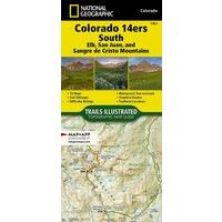
NATIONAL GEOGRAPHIC WANDELKAART COLORADO 14ERS ZUID (9781566957007) IS NIET LEVERBAAR
Dit artikel is niet leverbaar. Het wordt niet meer gemaakt, zit niet meer in ons assortiment, of kunnen wij er simpelweg (nu) niet aan komen.
Artikelen die wij wel op voorraad hebben in deze groep (Pacific Northwest & Alaska):


OMSCHRIJVING
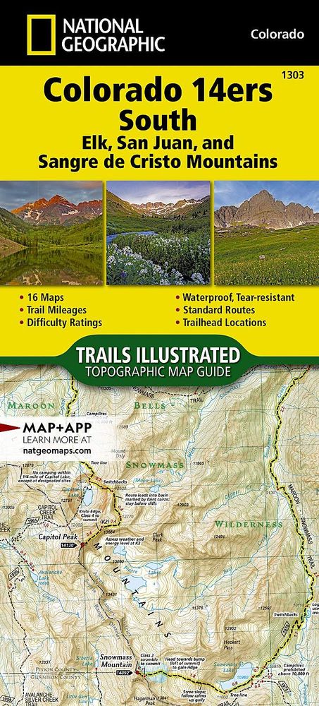
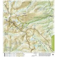
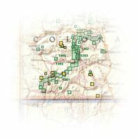
Gedetaileerde wandelkaartgids van de zuidelijke 14000ers in Colorado (San Juan, Elk, and Sangre de Cristo Mountains):
- kaartgids (gevouwen als boekje) met aadrin 16 wandelkaarten met daarop ingetekende trails met moeilijkheidsaanduiding
- gedrukt op waterproof en scheurbestendig papier
- met ingetekende wandelpaden en campsites
- schaal 1:63.360 (1 cm = 636 meter)
- hoogtelijnen
- mooi kleurgebruik
- GPS-compatible
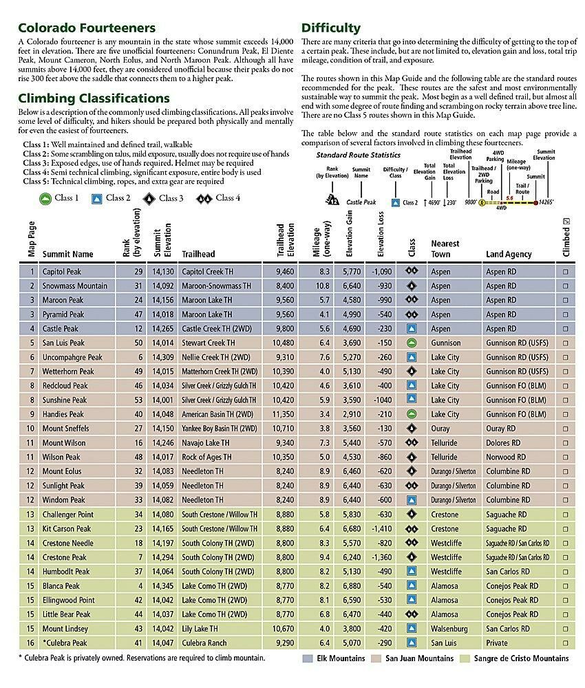
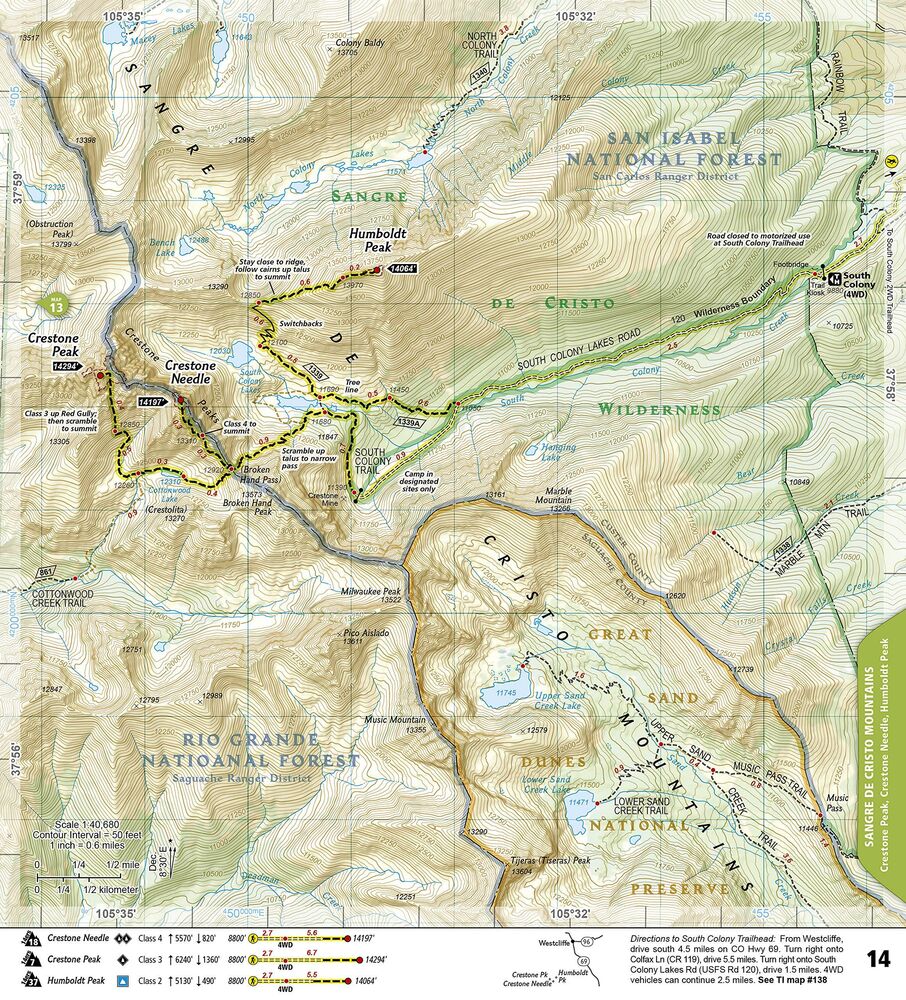
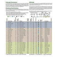
Each map page provides accurate trail statistics including trail mileages, total elevation gain and loss, trailhead elevations and elevations at trail junctions, and directions to trailheads. Route information includes climbing class (i.e. difficulty rating) and points of reference along the route. The maps include both 2WD and 4WD trailhead locations for the standard, recommended route. The standard route is the most sustainable route recommended by land managers in effort to preserve the fragile alpine environment of these peaks.
More convenient and easier to use than folded maps, but just as compact and lightweight, National Geographic's Topographic Map Guide booklets are printed on "Backcountry Tough" waterproof, tear-resistant paper with stainless steel staples. A full UTM grid is printed on the map to aid with GPS navigation.
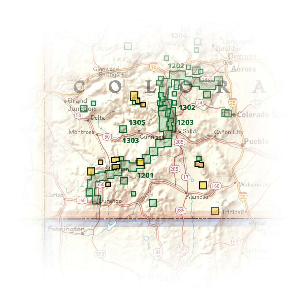
- Elk Range: Capitol Peak, Castle Peak, Conundrum Peak*, Maroon Peak, North Maroon Peak*, Pyramid Peak, Snowmass Mountain
- San Juan Range: El Diente Peak* , Mount Eolus, North Eolus*, Handies Peak, Redcloud Peak, San Luis Peak, Mount Sneffels, Sunlight Peak, Sunshine Peak, Uncompahgre Peak, Wetterhorn Peak, Mount Wilson, Wilson Peak, Windom Peak
- Sangre De Cristo Range: Blanca Peak, Challenger Point, Crestone Needle, Crestone Peak, Culebra Peak, Ellingwood Point, Humboldt Peak, Kit Carson Peak, Mount Lindsey, Little Bear Peak
Bekijk alle Noord- & Zuid-Amerika
OMSCHRIJVING
- kaartgids (gevouwen als boekje) met aadrin 16 wandelkaarten met daarop ingetekende trails met moeilijkheidsaanduiding
- gedrukt op waterproof en scheurbestendig papier
- met ingetekende wandelpaden en campsites
- schaal 1:63.360 (1 cm = 636 meter)
- hoogtelijnen
- mooi kleurgebruik
- GPS-compatible
Each map page provides accurate trail statistics including trail mileages, total elevation gain and loss, trailhead elevations and elevations at trail junctions, and directions to trailheads. Route information includes climbing class (i.e. difficulty rating) and points of reference along the route. The maps include both 2WD and 4WD trailhead locations for the standard, recommended route. The standard route is the most sustainable route recommended by land managers in effort to preserve the fragile alpine environment of these peaks.
More convenient and easier to use than folded maps, but just as compact and lightweight, National Geographic's Topographic Map Guide booklets are printed on "Backcountry Tough" waterproof, tear-resistant paper with stainless steel staples. A full UTM grid is printed on the map to aid with GPS navigation.
- Elk Range: Capitol Peak, Castle Peak, Conundrum Peak*, Maroon Peak, North Maroon Peak*, Pyramid Peak, Snowmass Mountain
- San Juan Range: El Diente Peak* , Mount Eolus, North Eolus*, Handies Peak, Redcloud Peak, San Luis Peak, Mount Sneffels, Sunlight Peak, Sunshine Peak, Uncompahgre Peak, Wetterhorn Peak, Mount Wilson, Wilson Peak, Windom Peak
- Sangre De Cristo Range: Blanca Peak, Challenger Point, Crestone Needle, Crestone Peak, Culebra Peak, Ellingwood Point, Humboldt Peak, Kit Carson Peak, Mount Lindsey, Little Bear Peak
Bekijk alle Noord- & Zuid-Amerika
PRODUCTINFORMATIE NATIONAL GEOGRAPHIC WANDELKAART COLORADO 14ERS ZUID
PRODUCTINFORMATIE NATIONAL GEOGRAPHIC WANDELKAART COLORADO 14ERS ZUID
HET MERK NATIONAL GEOGRAPHIC

National Geographic is voor al bekend om zijn fraaie natuurbeelden die iedereen weleens gezien heeft. Ook het blad National Geographic is bij menig persoon bekend. Daarnaast heeft National Geographic uitstekende reisgidsen (Engels en Nederlands) en prima wegenkaarten (Adventure Maps) en wandelkaarten van de Rocky Mountains en natuurparken in Noord-Amerika.
HET MERK NATIONAL GEOGRAPHIC
National Geographic is voor al bekend om zijn fraaie natuurbeelden die iedereen weleens gezien heeft. Ook het blad National Geographic is bij menig persoon bekend. Daarnaast heeft National Geographic uitstekende reisgidsen (Engels en Nederlands) en prima wegenkaarten (Adventure Maps) en wandelkaarten van de Rocky Mountains en natuurparken in Noord-Amerika.
GARANTIE
Of u het product online via de webshop of in onze fysieke winkel gekocht heeft, de garantie is voor Zwerfkei hetzelfde. De garantietermijn kan per product en merk verschillen, van één jaar tot de volledige levensduur van het product. Garantie geldt in principe op alle materiaal- en/of fabricagefouten, en niet op defecten als gevolg van slijtage of verkeerd gebruik. In het geval van garantie wordt het defecte product vervangen, vergoed of hersteld door de fabrikant/importeur of door een professionele en gespecialiseerde reparateur.
Zwerfkei verzorgt de begeleiding en de afhandeling van garantiegevallen voor u. Wij bieden het product na beoordeling ter reparatie aan bij de fabrikant/importeur of één van hun professionele servicediensten. Wij onderhouden goede contacten met onze servicediensten en samen zorgen wij ervoor dat elk defect zo snel mogelijk opgelost wordt.
NATIONAL GEOGRAPHIC WANDELKAART COLORADO 14ERS ZUID KOPEN?
KEUZEHULP
OPENINGSTIJDEN
| Ma | 13:00 - 18:00 uur |
| Di | 09:00 - 18:00 uur |
| Wo | 09:00 - 18:00 uur |
| Do | 09:00 - 18:00 uur |
| Vr | 09:00 - 21:00 uur |
| Za | 09:00 - 17:00 uur |
| Zo | gesloten |
3446 CR Woerden
0348-421648
ANDERE KLANTEN KOCHTEN OOK